Maps is unique among Apple system apps. Most system apps, like Notes or Reminders, are only updated at the same time that major revisions of the company’s underlying operating systems are released. Tweaks are sometimes made with OS point releases but never separate from the OS updates themselves.
Maps is different because so much of the experience is tied to the data that the app delivers. That allows Apple to add mid-cycle updates that aren’t tied to an OS release. There are many recent examples, like the addition of COVID-19 travel guidance for airports, vaccination site locations, and places offering volunteer opportunities. At the same time, the company continues to expand and enhance the accuracy and detail offered by Maps at a deeper level with its ongoing initiative to rebuild the app’s underlying maps worldwide.
Apple has been at it, improving Maps since iOS 6, and it’s a task that by definition will never truly be finished. However, the introduction of new features in recent years and broader expansion of its effort to deliver rebuilt maps to more of the world has allowed Apple to refine the app across the board. Using the latest map data the company has collected has enabled it to redesign the Maps experience, providing more relevant information to users, and expanding its view of the world around us.
Details and Design
Maps is packed with an extraordinary number of design changes. I’m going to hit the highlights and leave the nitty-gritty details to Justin O’Beirne, who has been cataloging everything from changes to the character spacing of the fonts to the shade of blue used to depict water. O’Beirne’s website is a treasure trove of fine detail, all carefully organized and illustrated to highlight the differences. It’s worth browsing to get a sense of the breadth of the changes that have been made since WWDC.
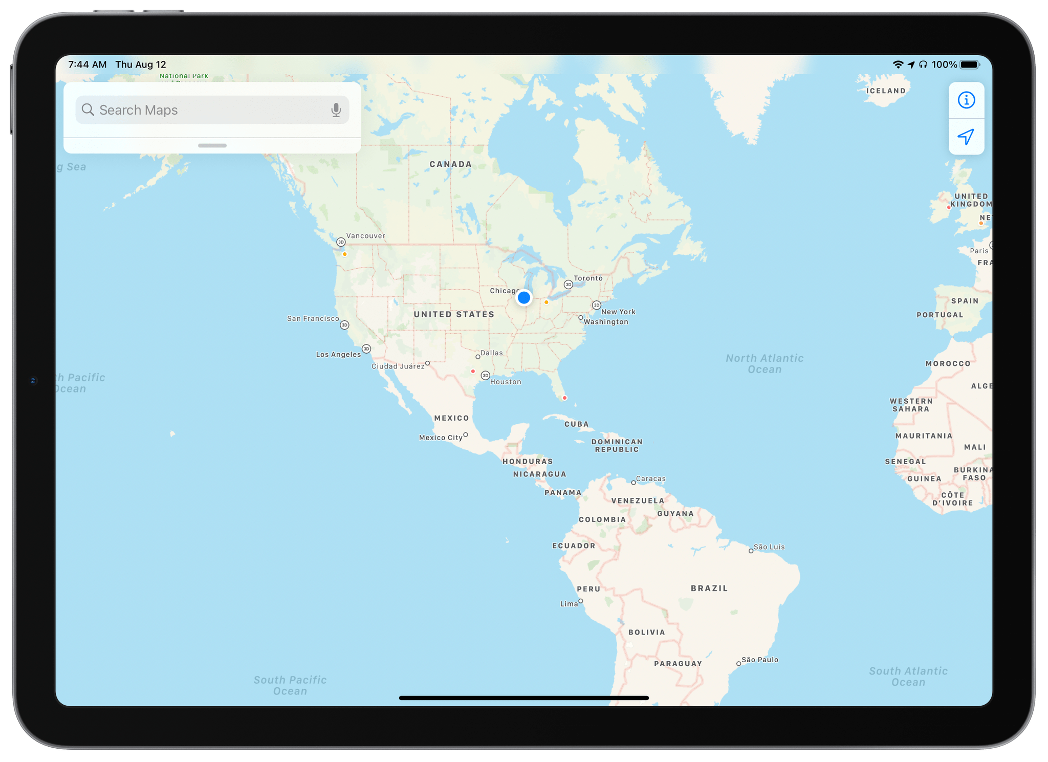
The extent of the design changes is evident at every zoom level. In the past, if you zoomed out as far as possible in Maps, you’d see a pannable rectangular map. The map looped back on itself, making it easy to make a quick loop around the Earth, but the effect felt off because it had no real-world analog. It was as though Maps was attached to the belt of a treadmill that was just offscreen. It worked to make navigating regions faster but was inelegant.
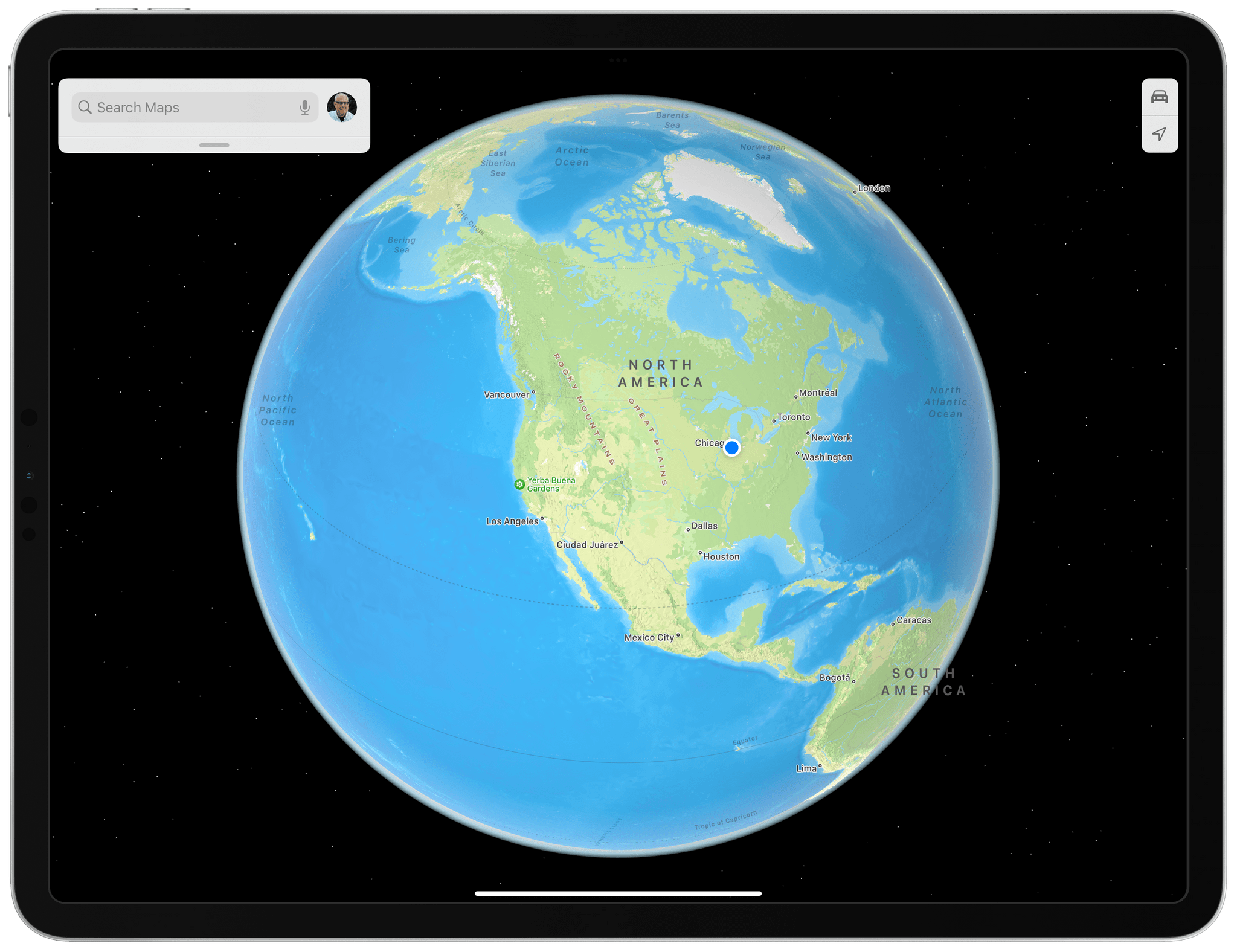
In contrast, Maps now offers a zoomed out globe view on all platforms with the exception of Intel Macs that are otherwise compatible with Monterey.
With iOS and iPadOS 15 and macOS Monterey, Apple has introduced an actual globe view of the Earth set against a field of stars. It’s worth noting, however, that the globe view is not available on Intel-based Macs. The globe identifies the continents and oceans and uses shades of green, tan, blue, and white to distinguish between things like deserts, oceans, and polar regions. This isn’t a view that I expect I’ll use any more than I have in the past, which isn’t much, but it does provide a better sense of where you are on the globe, making it easier to find an area to explore further.
Exploration is at the heart of this year’s update to Maps at every level of the app. If I spin the globe and land on Europe and start zooming in, features of the landscape emerge that weren’t available before. Waterways come into view, and the peaks of the Alps come into focus, for example. Before, you’d have to zoom in closer before the level of detail changed much, and even then, the primary features would be major roadways and patches of green and blue here and there. The new terrain detail coming this fall provides a much better sense of place than Maps did before.
In contrast, iPadOS 15 and the other updated versions of Maps make it easy to find mountains and other geographic features and learn more about them.
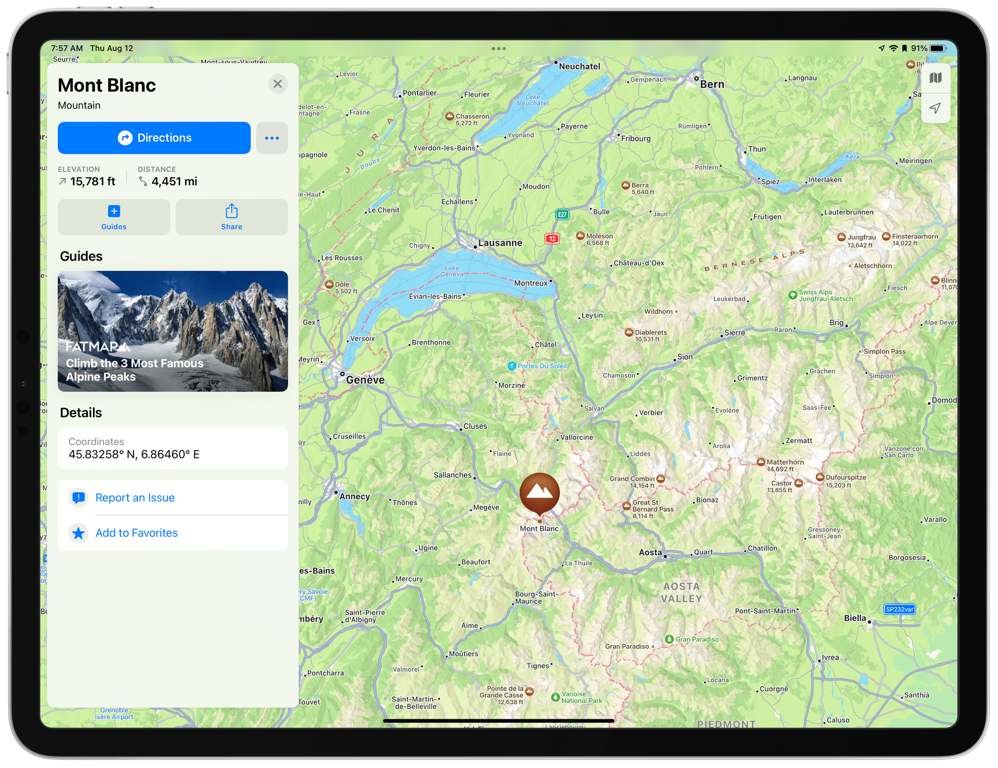
Terrain features have also gained their own place cards too. If I zoom in on Mont Blanc, it now features a mountain icon and says the elevation is 15,781 feet. I can tap the icon to get more details and links to any related guides like the one shown in the screenshot above from Fatmap about climbing the three most famous alpine peaks. In contrast, there’s nothing at all in Maps for iOS and iPadOS 14 or Big Sur to indicate there’s a mountain where Mont Blanc is located. The Fatmap guide is still available, but only if I search for the peak. The new terrain place cards do a much better job surfacing details about locations than before.
The detail Apple has added at a high level extends to the local level as you zoom in, improving the continuity of the experience no matter what level of detail you’re viewing. The one caveat is that, as has been the case with past updates, not all locales have been updated with the same level of detail yet. It’s a process that understandably takes time, but I’m eager to see these new features appear here in the Chicago area and the rest of the world soon.
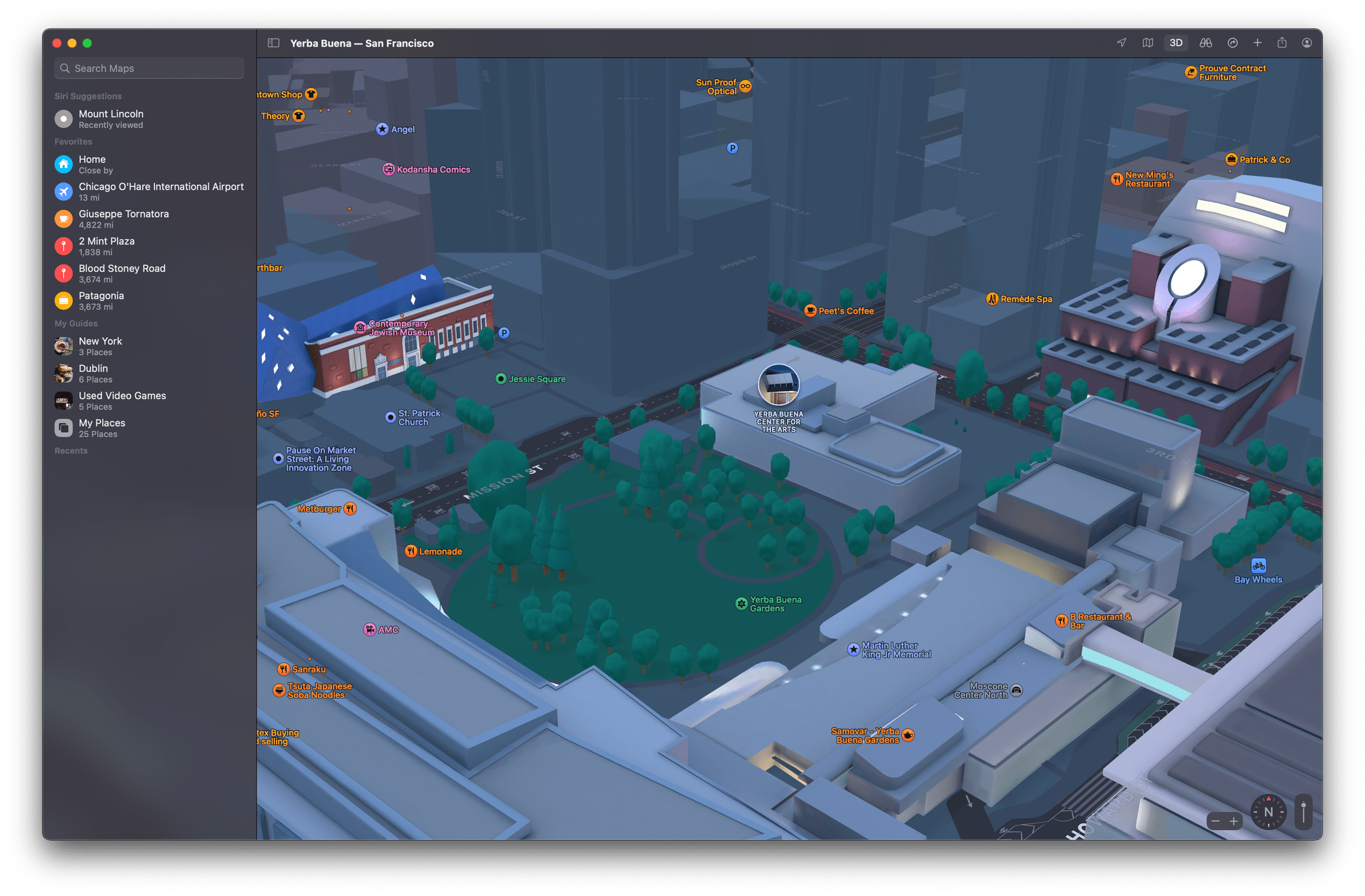
For now, the best demonstration of the new level of detail added is to zoom in on the Bay Area in California. Apple is introducing a collection of features that make navigating cities easier. As of the publication of this story, you’ll only find this level of detail in San Francisco and surrounding Bay Area communities, but the company has said it’s also coming to Los Angeles, New York, and London this fall.
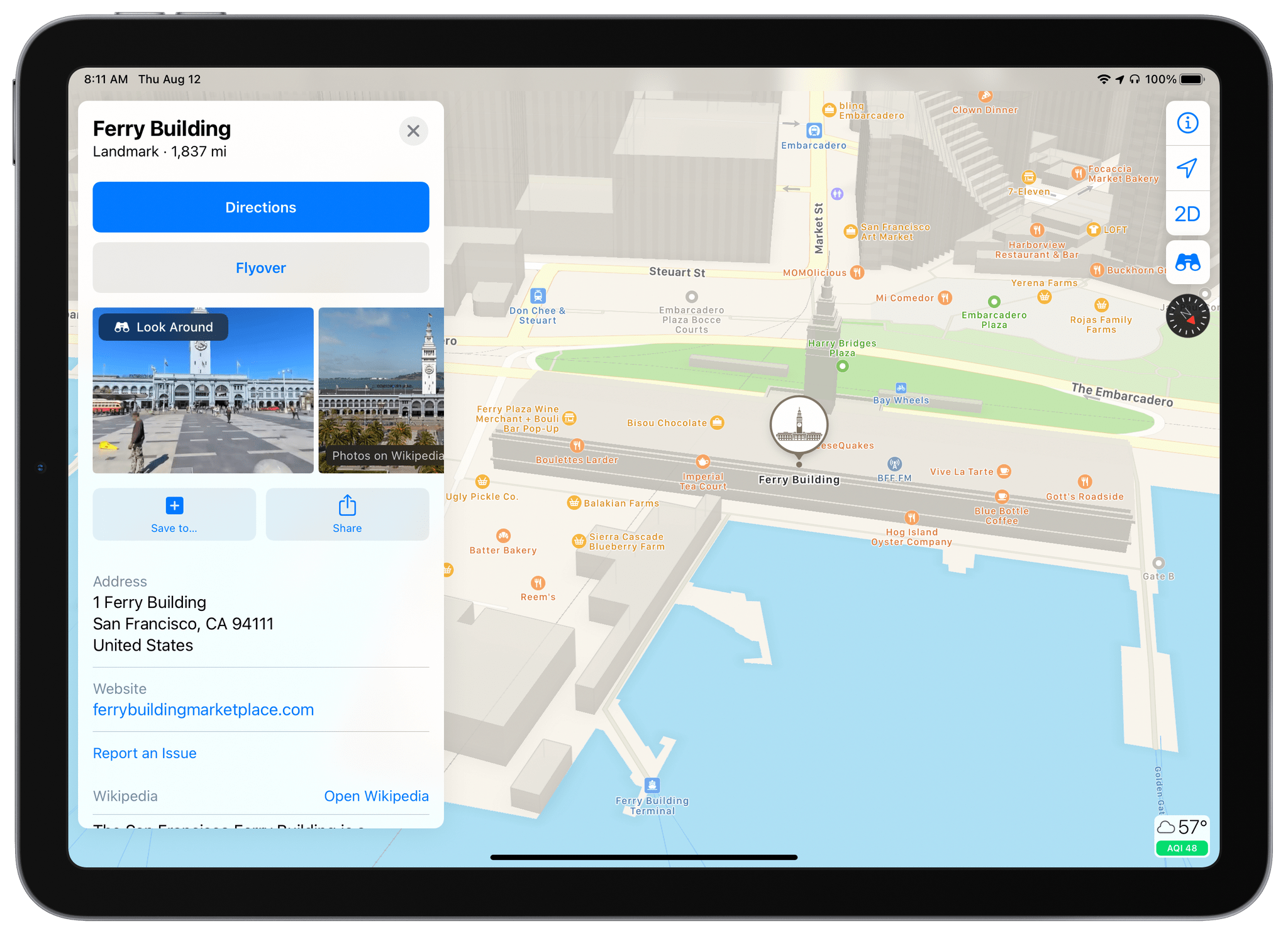
The marquee feature being added to Maps is detailed 3D models of landmarks. Here’s the Ferry Building in San Francisco viewed from the water looking up Market Street using Maps for iPadOS 14:
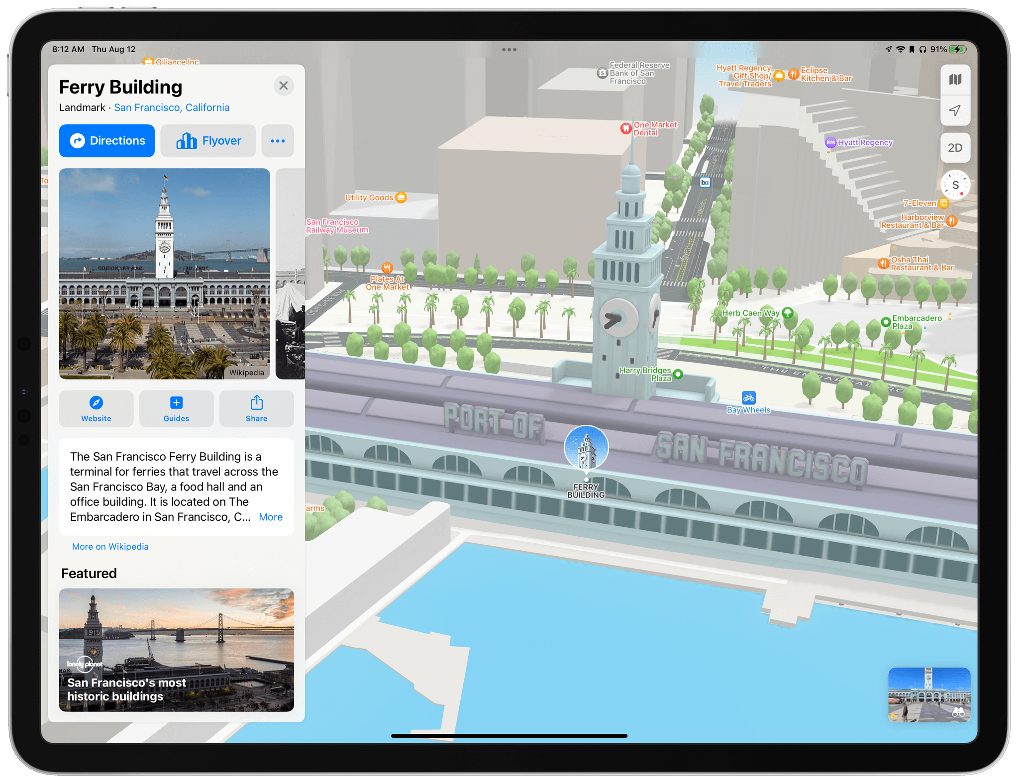
In contrast, here’s what it looks like on iPadOS 15:
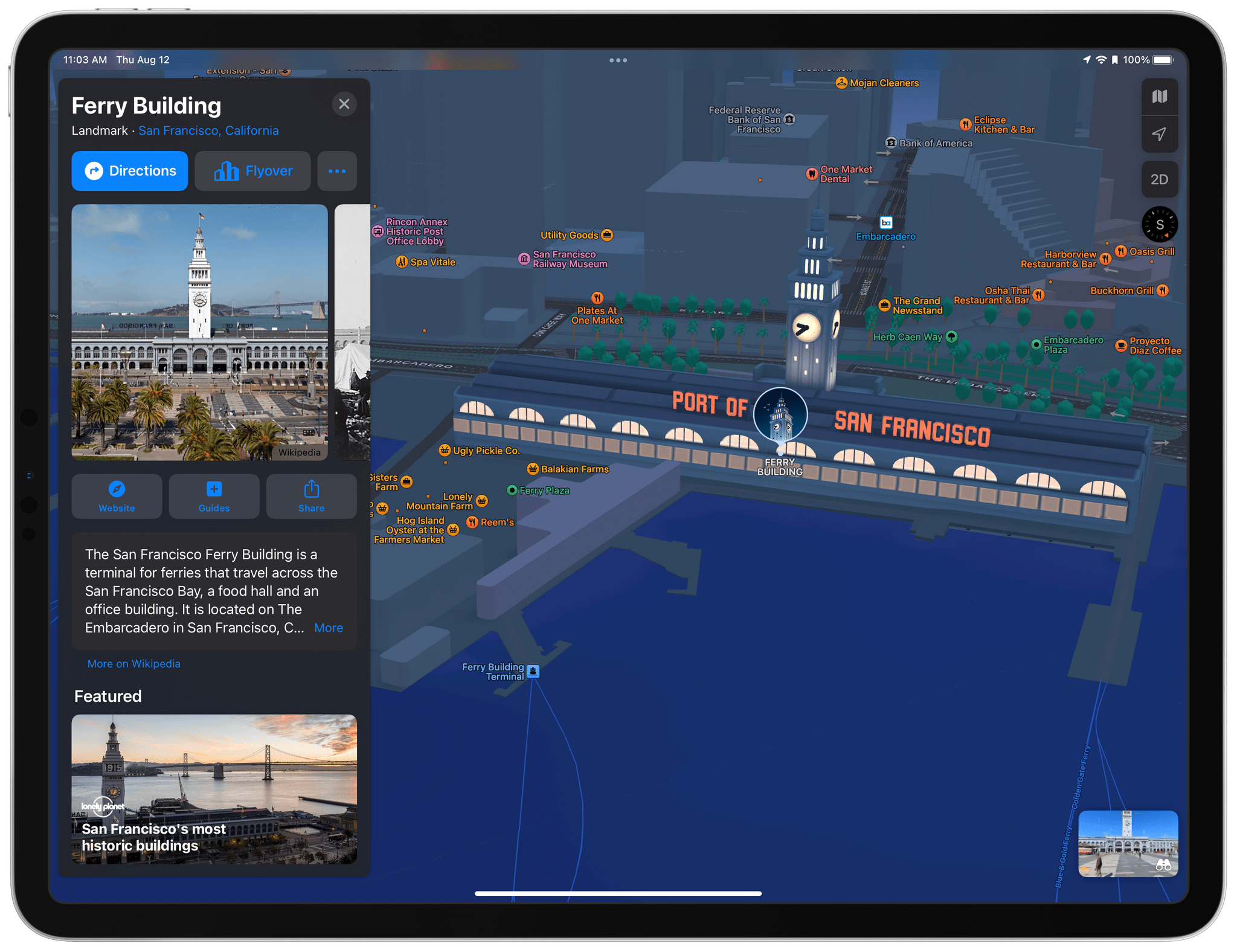
In dark mode, the models appear to be lit by the moon and the city’s lights:
There’s a lot of additional detail in this screenshot beyond the colorful 3D model of the Ferry Building. For example, not only are trees better defined, but Maps distinguishes between palm trees and other trees. You can also see lane markers and crosswalks on the streets, which, along with trolleys and bus stops, are new.
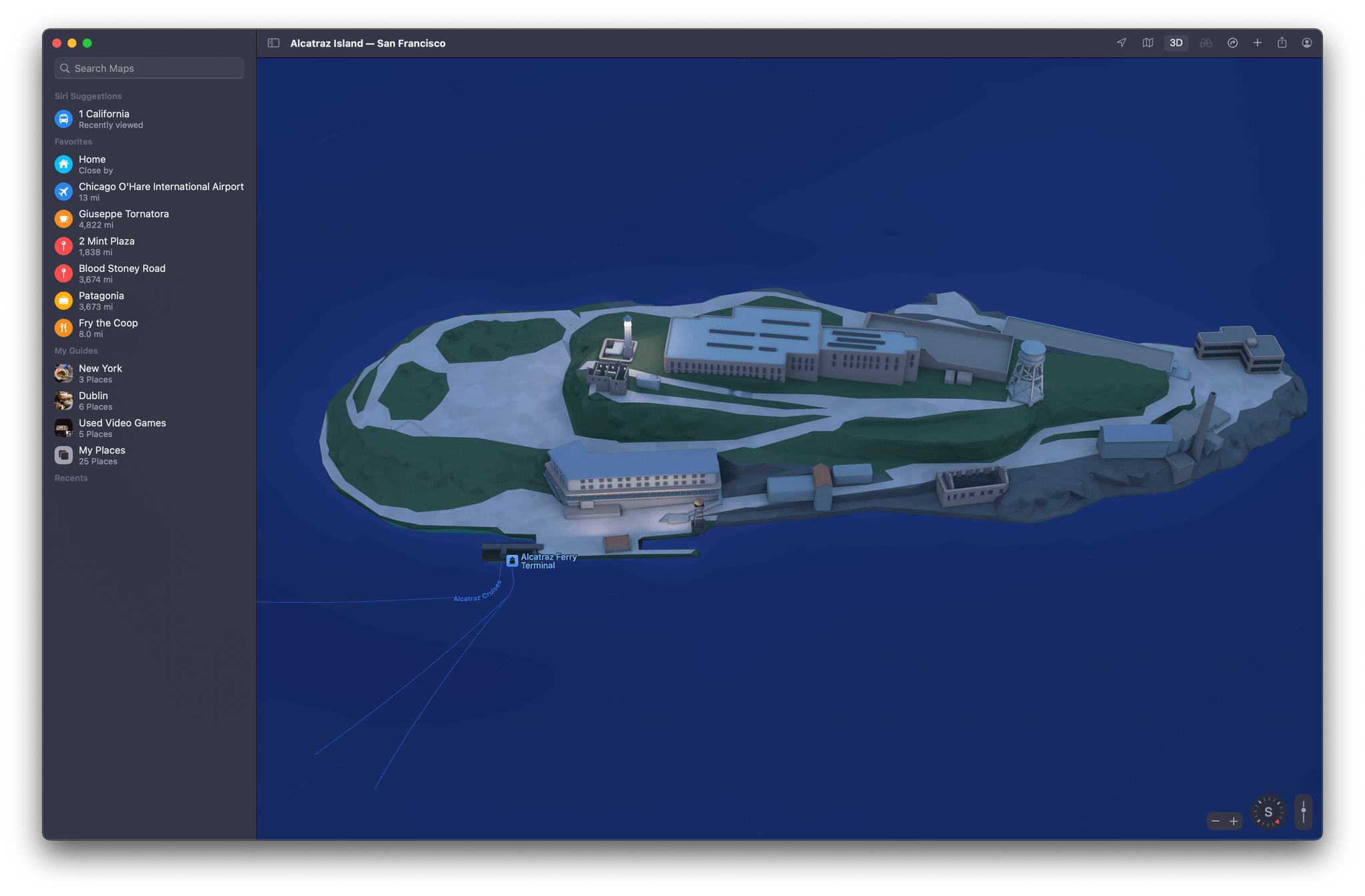
If you pan around San Francisco, you’ll find lots of other 3D models, from the Golden Gate Bridge to the Yerba Buena Gardens, which is shown at the beginning of this story, and even Alcatraz. Long term, I think the addition of 3D models to Maps will be an excellent way to plan a trip or simply learn more about a place with which you aren’t familiar. However, four cities at launch aren’t very many, making this a feature that will require some patience from users as Apple expands it globally.
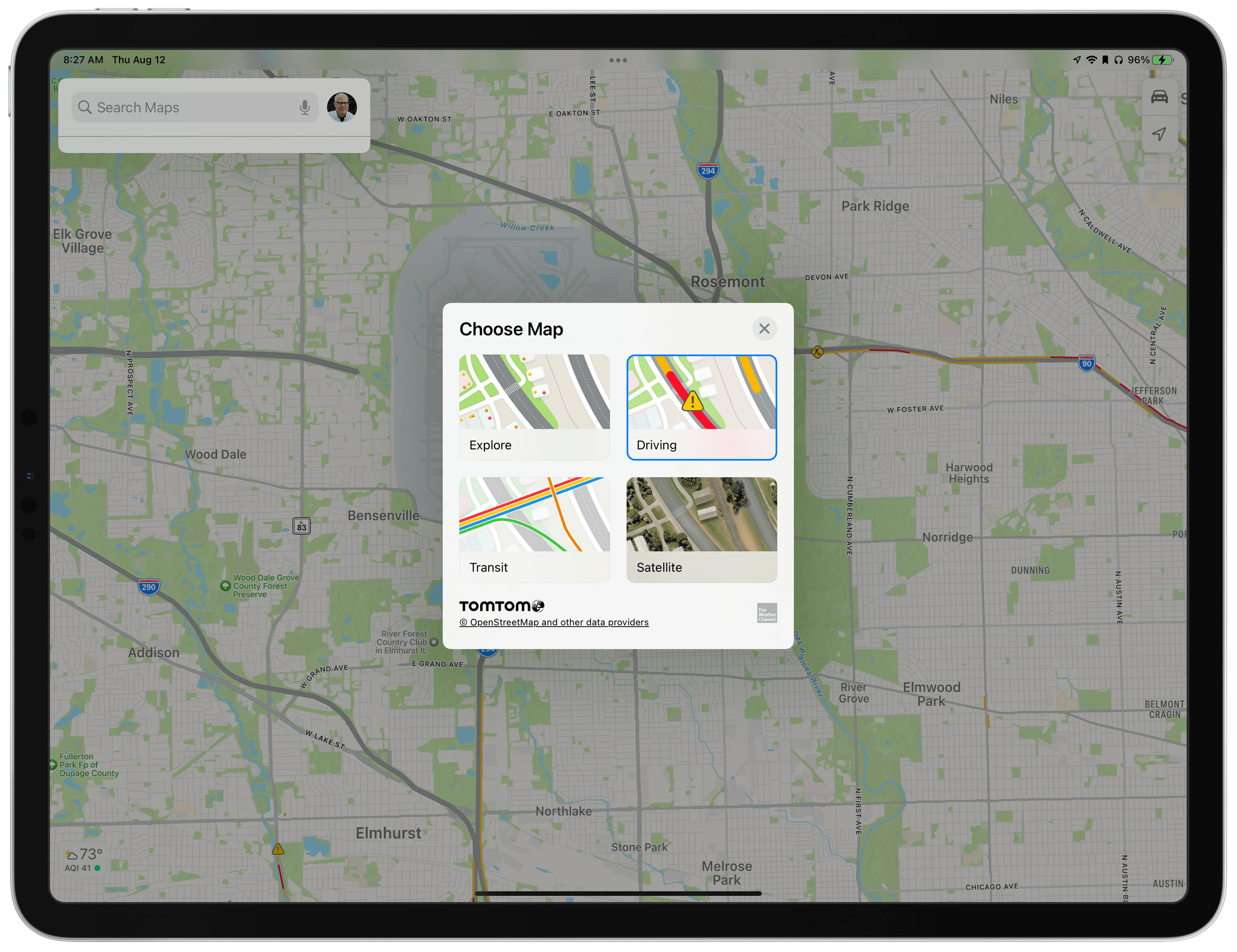
Maps will offer a new view this fall too called Driving, which joins Explore (previously ‘Map’), Transit, and Satellite, which are accessed from a button that floats above the map in the top right-hand corner of the screen on the iPhone and iPad and in the Mac app’s toolbar. The Driving view emphasizes traffic conditions, road hazards, lane closures, gas stations, and similar details that are most relevant to drivers. Congested areas will also display the length of delays.
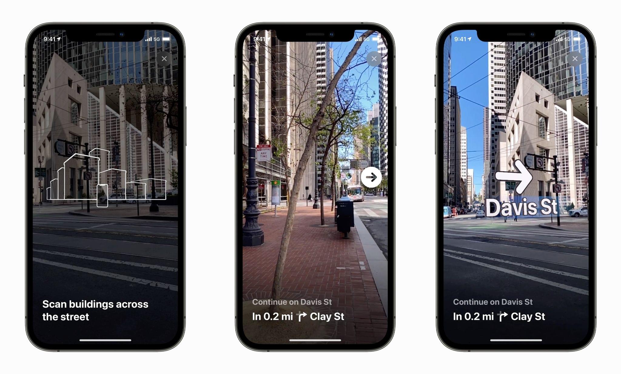
At the most hyper-local level possible, Apple has added augmented reality walking directions. The feature uses a live camera view of your surroundings overlaid with directions, arrows, and street names to help guide you to your destination. This feature, which requires an A12 or more recent chip, isn’t available where I live yet, so I haven’t had a chance to try it.
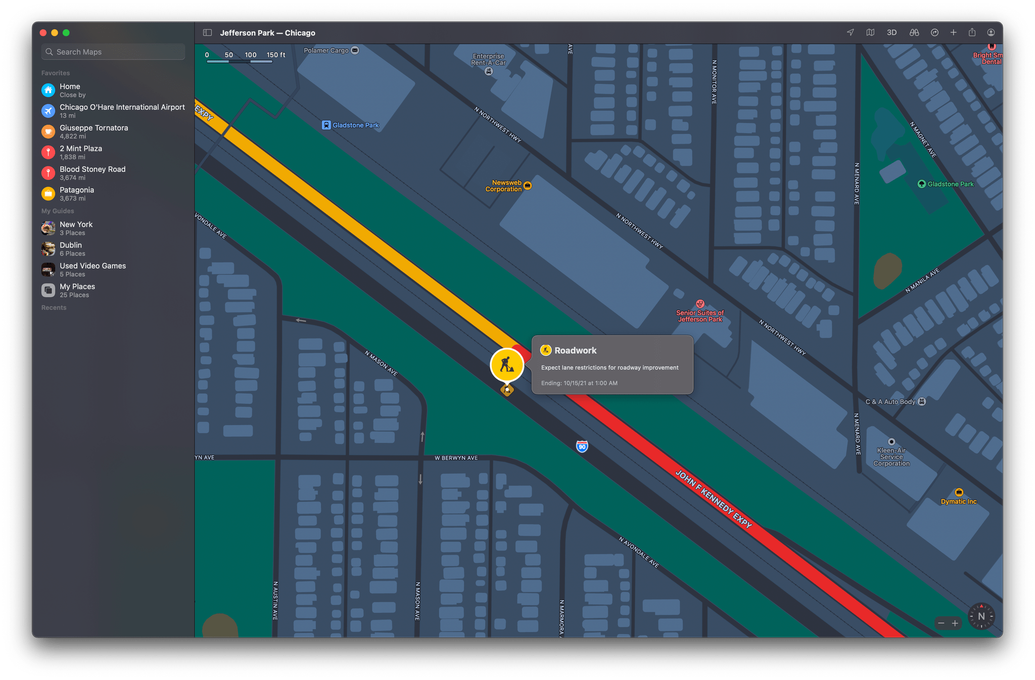
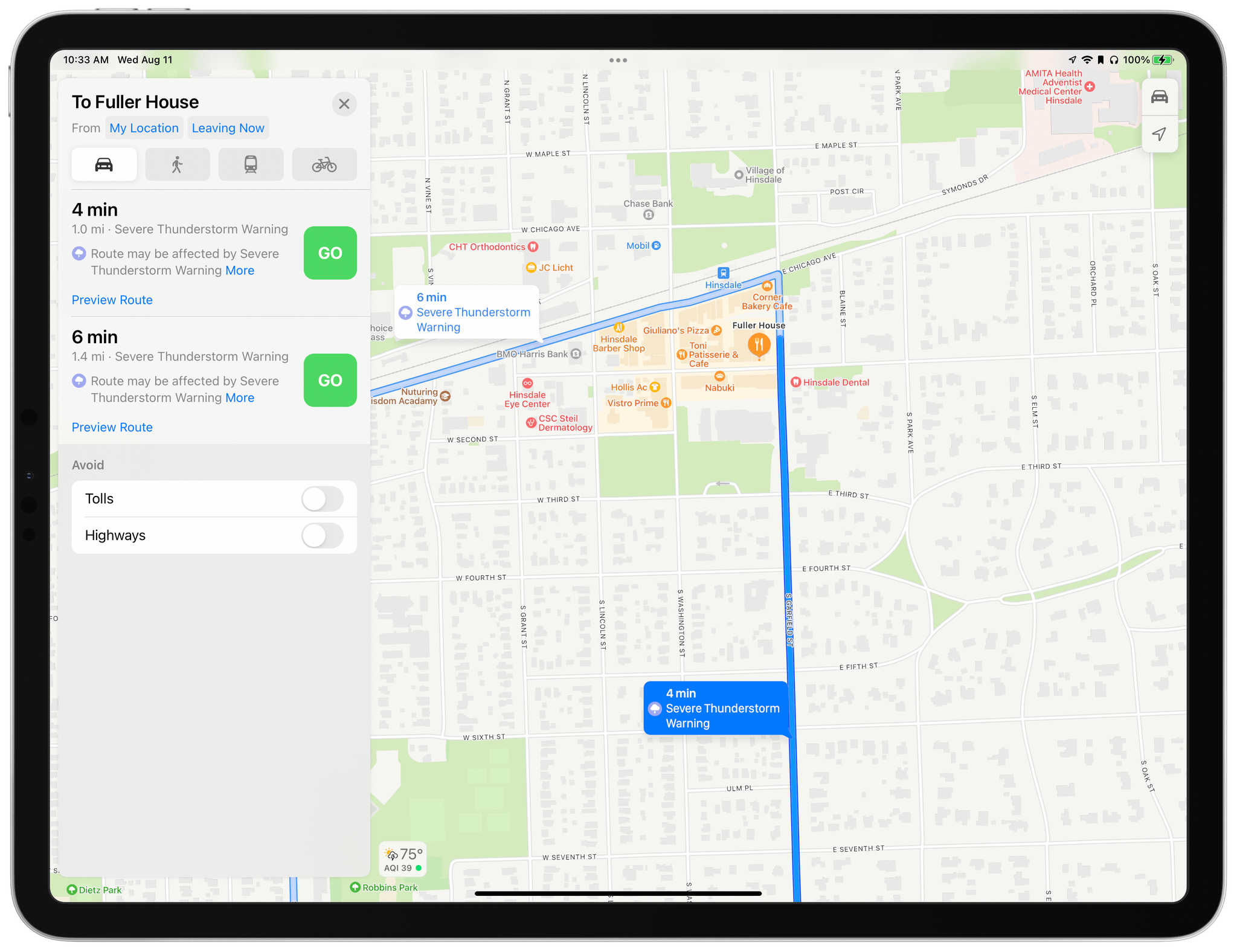
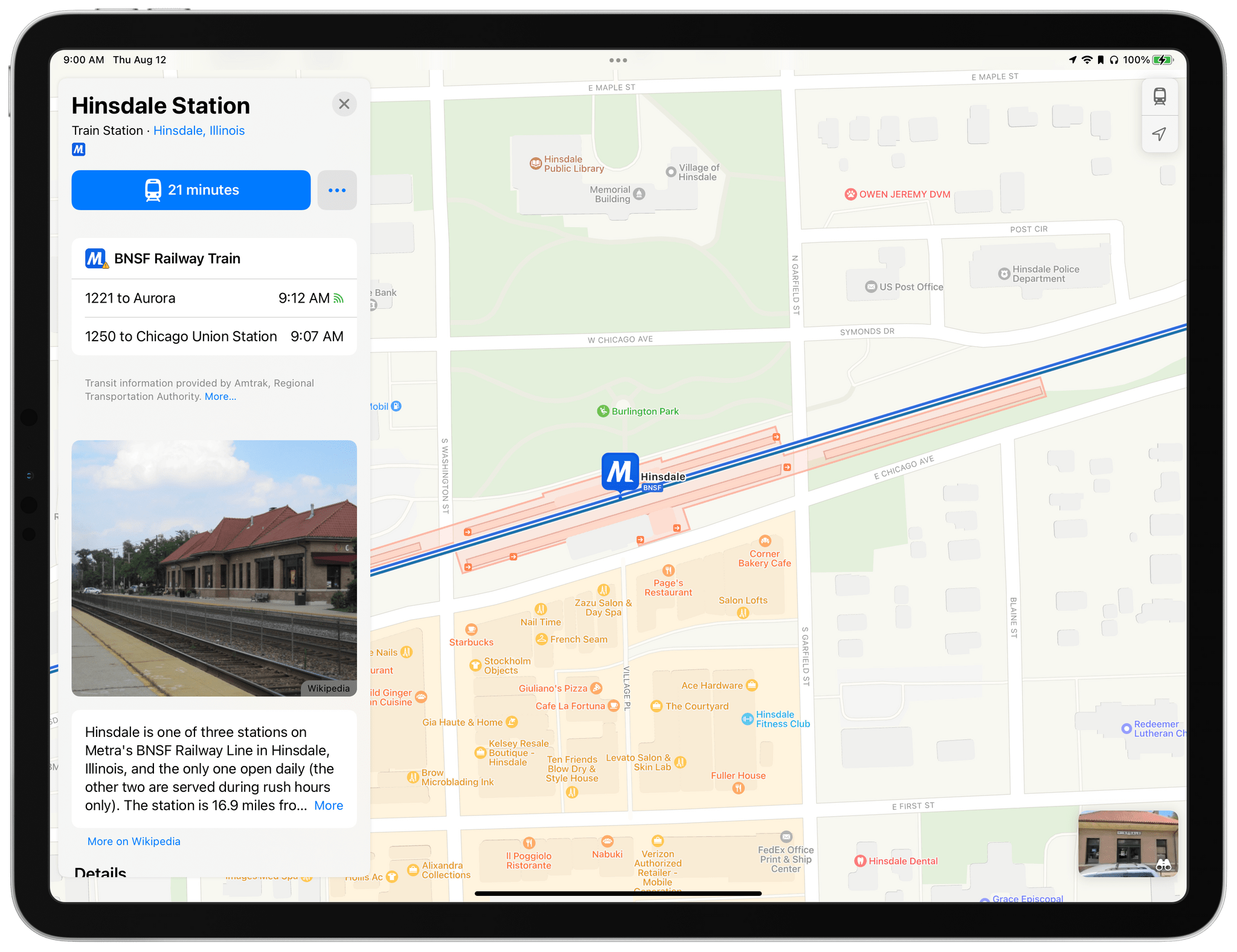
Other changes include the addition of weather alerts, which I was able to get screenshots of as I wrote this story thanks to the Chicago area’s mercurial weather. The Maps update will also add details about bus routes and train and bus departure times.
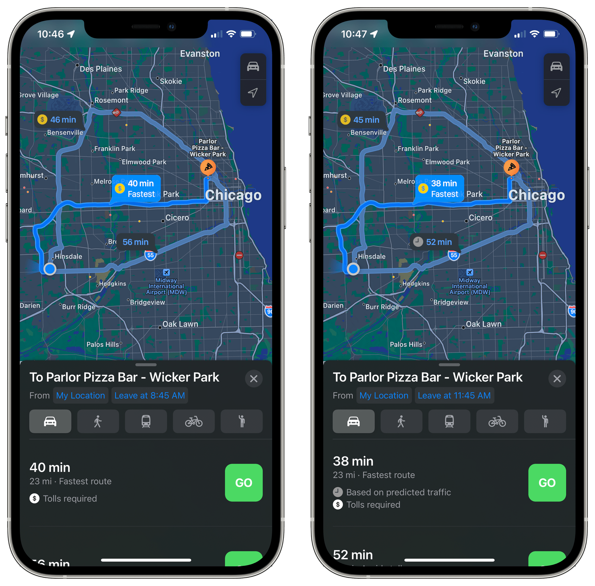
Drivers in cities with heavy rush hour traffic will appreciate that when setting up directions, Maps is adding a new button that defaults to ‘Leaving Now.’ Tap it, and you can set a different departure time or time by which you’d like to arrive at your destination. In my testing, the feature provides a better sense for when you should leave home because travel times account for traffic conditions depending on the time of day.
Search, Place Cards, and Guides
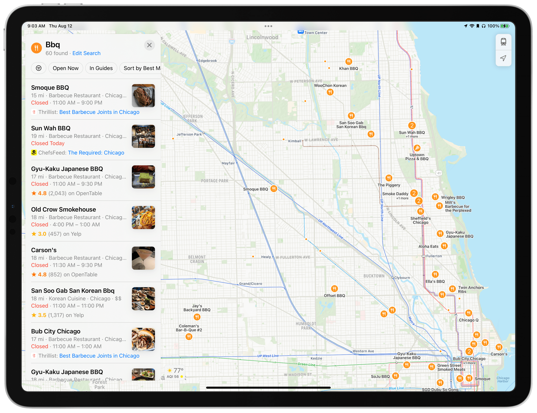
I’ve already touched on place cards and guides, but it’s worth digging into them in a little more detail, along with search. I want to start with search, which has gained a small but very welcome feature. Currently, if you search for something in Maps like BBQ restaurants nearby, Maps will drop pins for any search results within the area you’re viewing. However, if you panned to a different part of the map, perhaps a town or two away from where you’re looking, you’d have to tap a ‘Search Here’ button to update the results for the new location. With the OS updates coming this fall, Maps will automatically update your search results as you pan around the map. It’s a small touch, but one that eliminates a frequent frustration. Search results for restaurants can also be filtered by new criteria like whether a location is open, the type of cuisine it offers, and whether takeout is available.
Place cards, which are displayed as cards that slide up from the bottom of the iPhone’s screen, a panel on the iPad, and a popover on the Mac, have been redesigned and are packed with more information in the latest OS updates. As you can see in the screenshots below, the new place card design takes the basic information about a location and spreads it out a little with a more prominent title and larger, more glanceable details like whether the location is open, its star rating, cost, and other details. Also, the button that generates directions makes it clear what type of directions Maps will provide, such as driving or walking, and the time it will take to get there. Next to the directions button is a new More button that makes it easier to locate a menu for a restaurant using Yelp, for example. The button also provides options to create a contact, add an address to an existing contact, report an issue with a location to the Maps team, and add a location to your favorites.
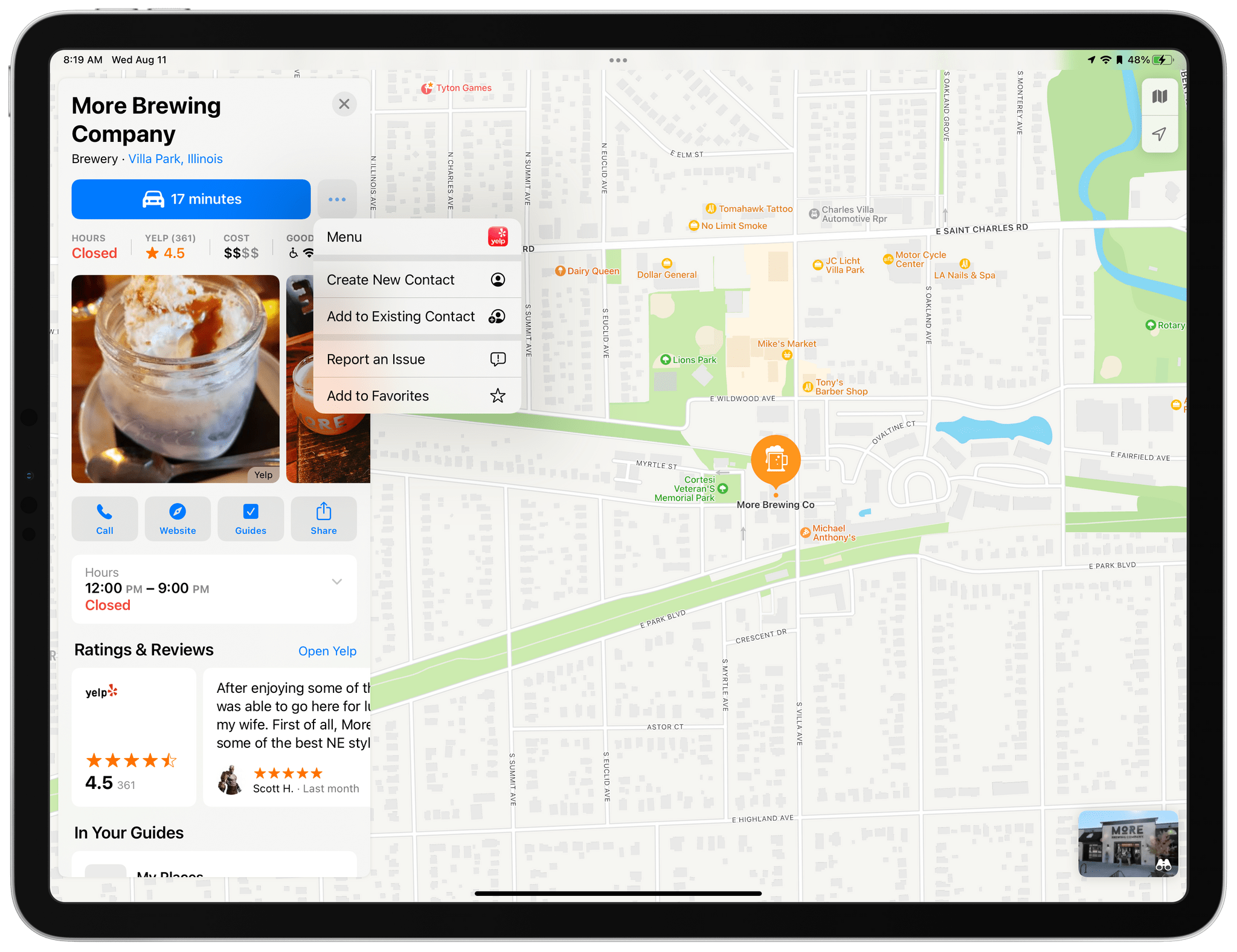
Place cards have new buttons for accessing your personal guides and adding a location to them, as well as a quick link to a location’s website. The ‘Useful to Know’ section has been renamed ‘Good to Know’ and has added more information, including more details about the accepted types of payments. The section has also added iconography that makes the list easier to read at a glance.
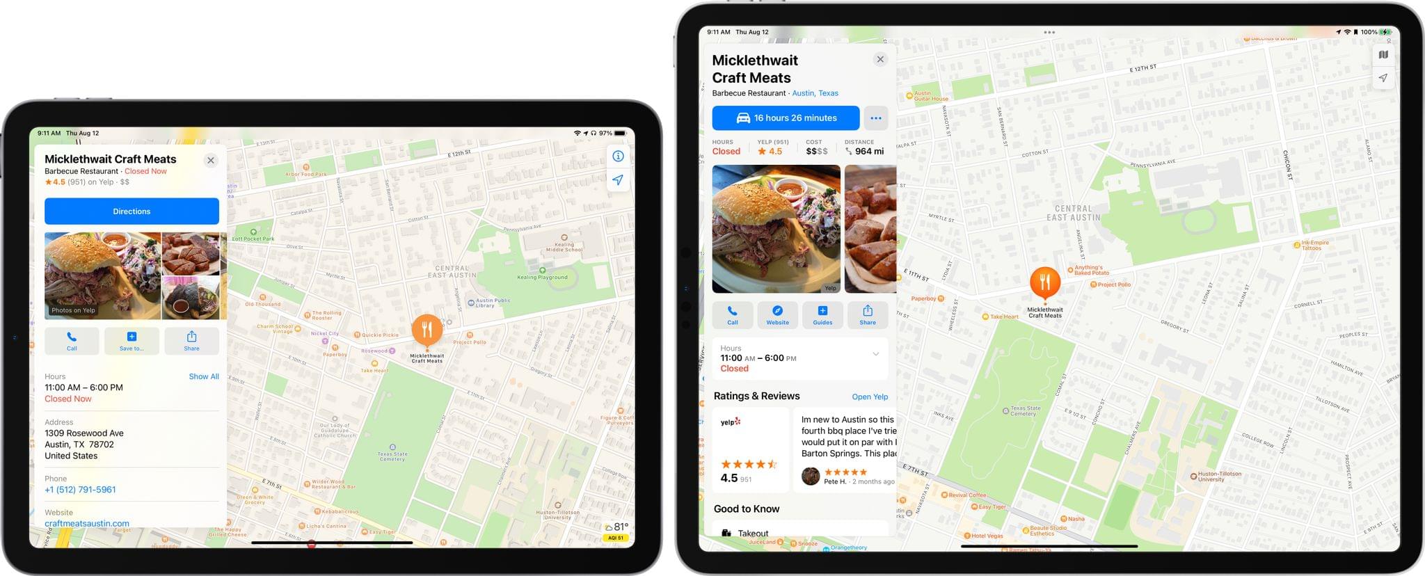
Compared side-by-side, it’s interesting to see the choices the Maps team has made. The latest design feels like a natural evolution of the existing design, but one that’s more readable overall and does a good job of moving certain actions to buttons that allow more information to be presented on each card. My biggest quibble with the design is the elevation of Yelp reviews to a more prominent position. Reading reviews can be useful, but I’d rather see more of the basic facts about a location that are in ‘Good to Know’ before I dig into reviews. Overall, however, the design is an improvement that will make exploring new locations easier.
I covered Guides in-depth last summer. They’re editorially curated collections of locations created by travel and other publications. Guides are one of those features that Apple has been quietly expanding throughout the past year. Last summer, the available Guides were limited, but you’ll find a long list of them featured more prominently this fall.
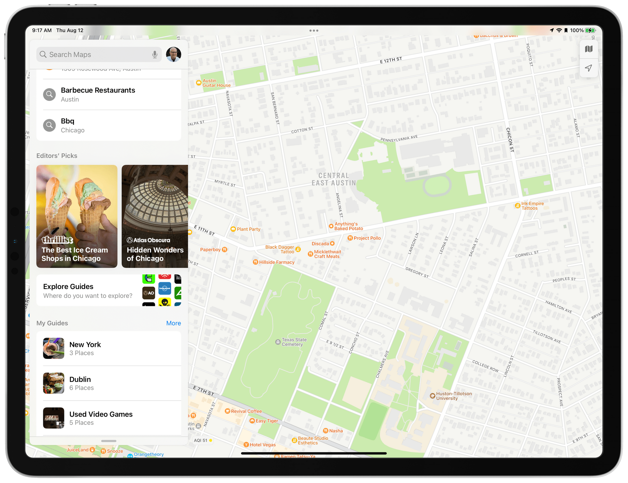
iOS and iPadOS 14 already included an Editors’ Picks section of Guides, but with version 15, both add an ‘Explore Guides’ button that replaces the search UI with Guides that can be explored globally or by city, along with themed collections, the latest additions, and the ability to browse by the dozens of publishers that have created them.
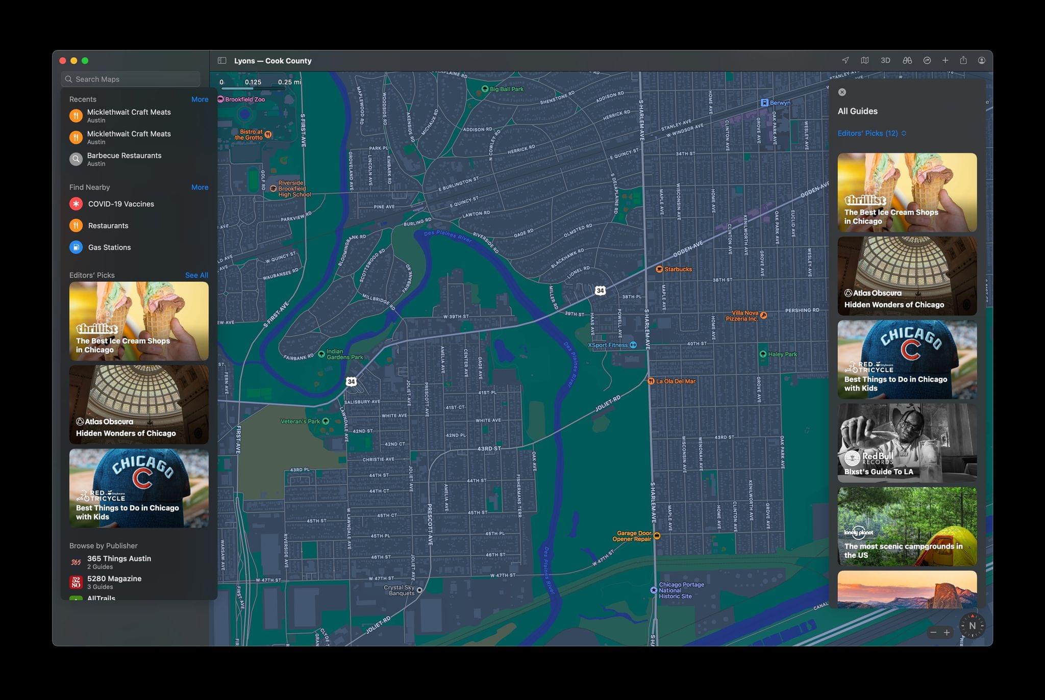
The experience on the Mac is a little different. There isn’t an ‘Explore Guides’ button, but when you click in the app’s search field, the same Editors’ Picks list that you find on the iPhone and iPad appears, and next to it, there’s a ‘See All’ link that opens a long list of every Guide available in Maps. What’s odd is that on the Mac, you can sort the list by a very long list of cities for which Guides have been produced, whereas the iPhone and iPad are limited to sorting Guides by San Francisco, Los Angeles, New York, and London – the cities where Guides debuted last year. We’re still in the midst of the beta cycle, so these differences may be eliminated before the public releases of the OSes in the fall, which I hope is the case.
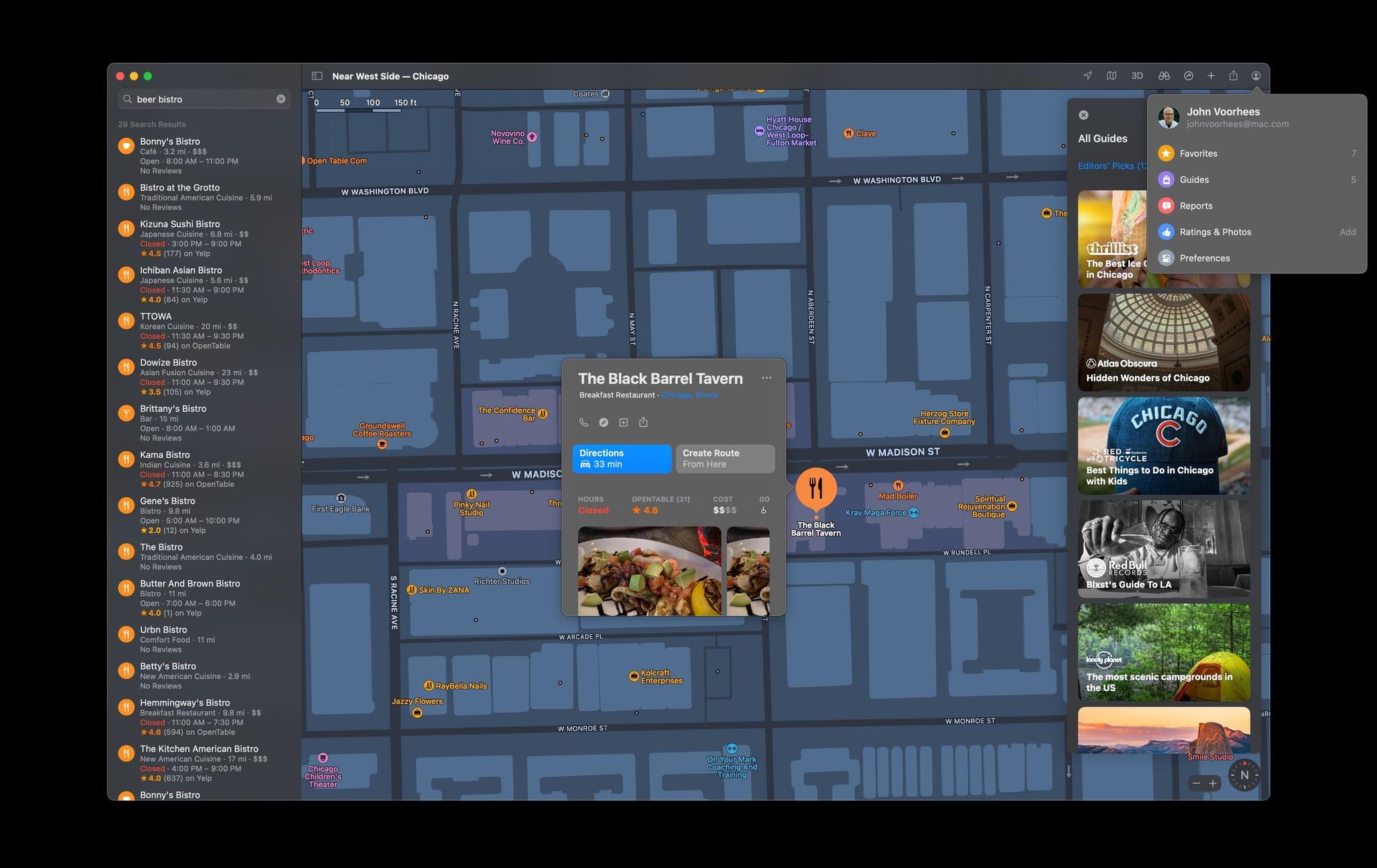
Finally, there’s a new user icon on all platforms that provides quick access to locations you’ve marked as favorites and guides you’ve created. This is also where you can report new locations to Maps and report issues with streets, places, and routes, and report traffic incidents. You’ll also find your Maps’ preferences here. Access to these features is sprinkled elsewhere throughout Maps’ UI, but I appreciate the ability to find them all in one easily accessed location.
Apple’s Map data has improved by leaps and bounds in recent years. It’s still better in some parts of the world than in others, but if you live or visit somewhere that has been recently mapped, it’s never been easier to explore the world around you, find your way to a destination, or manage your commute by car or public transit.
Last year, a big part of the Maps story was that it was rewritten as a Mac Catalyst app, bringing feature parity across every version. This year, the dividends of that investment are starting to be paid. The differences between each version of the app are minor, making the experience of going from a Mac where you might be researching an upcoming trip and creating a guide to walking around an unfamiliar city with your iPhone seamless. I haven’t had as many occasions to use Maps during the pandemic, but as I start to plan trips again, I’m looking forward to spending more time with the app. In the meantime, it continues to do an excellent job getting me around the Chicago area and alerting me to the omnipresent traffic jams.
You can also follow our 2021 Summer OS Preview Series through our dedicated hub, or subscribe to its RSS feed.