This Week's Sponsor:

Listen Later

Listen to Articles as Podcasts


Posts tagged with "google maps"

New Google Maps for the Web Previewed, iPad App Expected This Summer

Google demonstrated a new version of Google Maps during the Google I/O 2013 keynote today, showcasing a full screen maps application for the web that reacts to every click. Redesigned in an effort to put an emphasis on directions and places, Maps’ new interface is focused on discovery. As you click, Maps will surface contextual information about what you can find at a desired location through a carousel and contextual cards, highlighting popular tourist attractions, directions to that place, and street views so you know exactly what to expect when you get there. Based on photos taken in the area, Google will even create tours so you can easily plan your next trip.

It’s contextually aware too: taking into account location information from your Google account, such as where you live and where you work, Google Maps will make recommendations on places to visit, utilizing reviews from Zagat and recent places your friends on Google+ have visited to highlight what’s popular in the area. It’ll also highlight new places you might be interested in based on your previous search history.

Maps will be much faster than before, as vector maps are replacing tile-based maps on the web, bringing it up to date with Android and iOS. For WebGL-enabled browsers, Google Earth is now a part of the web app and can be activated through a simple toggle for viewing 3D imagery. Just the like the desktop app, you can zoom out and fly around the entire planet or just around your favorite locale.

You can request an invite to preview the update for Google Maps before it hits the web at http://maps.google.com/preview.

Google also talked about updates to their mobile applications, announcing than an iPad app will be arriving in the summer. Building upon the interface introduced with Google Maps on iOS, Google will be bringing in global traffic data and alerts for live reports on incidents and accidents, no matter where you’ll be going. Google Offers will also be integrated, giving you a heads up on nearby deals from restaurants and department stores so that you can take advantage of discounts and special offers.

Be sure to additionally check out The Verge for their great rundown on the new Google Maps for the web and what to expect for mobile devices for more information.

[via Google Maps]


Open Google Maps Directions With Siri or Launch Center Pro

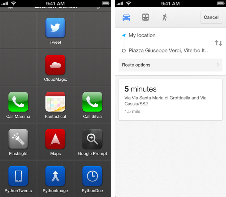
Here’s a fun experiment to launch the Google Maps app via URL scheme directly into a new Directions view.

As I detailed this morning, the new Google Maps app for iPhone lets you launch specific views and modes using a URL scheme. You don’t need to be a developer to use the URL scheme; this means you’ll be able to launch the Google Maps app from Safari, Launch Center Pro, or any other launcher using the base comgooglemaps:// URL.

Google’s URL has a scheme for directions with addresses and transportation parameters. It lets you specific a starting address with the saddr parameter, and a destination address with daddr.

Further, you can instruct the URL to open a specific directionsmode, such as driving or transit.

With these parameters, it becomes possible to set up a nice automated workflow to launch directions using Siri or Launch Center Pro. Read more


Google Maps SDK For iOS And URL Scheme

Google Maps SDK For iOS And URL Scheme

Alongside the launch of its official Maps app for iPhone, Google has also released a developer SDK to let third-party apps embed Google Maps directly. As detailed by Andrew Foster at the Google Geo Developers blog, the SDK – which requires signing up for API access – will allow developers to integrate Google Maps with their own apps, displaying embedded 2D or 3D Maps views with markers and info windows. The blog post also confirms that the SDK will work on the iPad; Google has confirmed to The New York Times that a native iPad version of Maps is indeed coming.

The SDK features vector-based maps that load quickly, allowing users to easily navigate 2D and 3D views, rotating and tilting the map with simple gestures inside your app. Developers can also change the Google maps view to include information such as traffic conditions, and control camera positions in 3D.

In the SDK documentation, Google says that the appearance of Maps embedded through the SDK is the same of the Google Maps apps, and that the SDK “exposes many of the same features”.

However, the SDK isn’t the only way for developers to integrate with Google Maps. Using a URL scheme, developers can point to the Google Maps app and launch it from their app into a specific view or map object. Documentation for the URL scheme is available here. Developers can link to Google Maps with specific views, modes (standard or Street View), set zoom levels, and pass directions with the URL scheme.

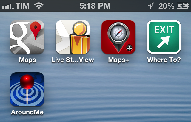
It’ll be interesting to see how and when Google Maps-compatible apps such as AroundMe or WhereTo will support the new Google Maps SDK. The addition of a URL scheme shouldn’t be underestimated either, as it’ll enable regular users to launch the app using tools like Launch Center Pro.

Permalink

Google Releases Maps App For iPhone

In spite of “sources at Google” claiming that Apple wouldn’t accept a Google Maps app in the App Store, Google has today released its official Maps application for iPhone. The app just went live on the App Store, and it’s available as a free download here.

Following Apple’s debacle with their Maps software for iOS 6, Google was rumored to be preparing a third-party version of Google Maps for iOS devices. We haven’t been able to test this yet, and we’ll post our impressions of the software on MacStories once we’re able to properly use the app. Read more


Getting Google Maps Back On iOS 6

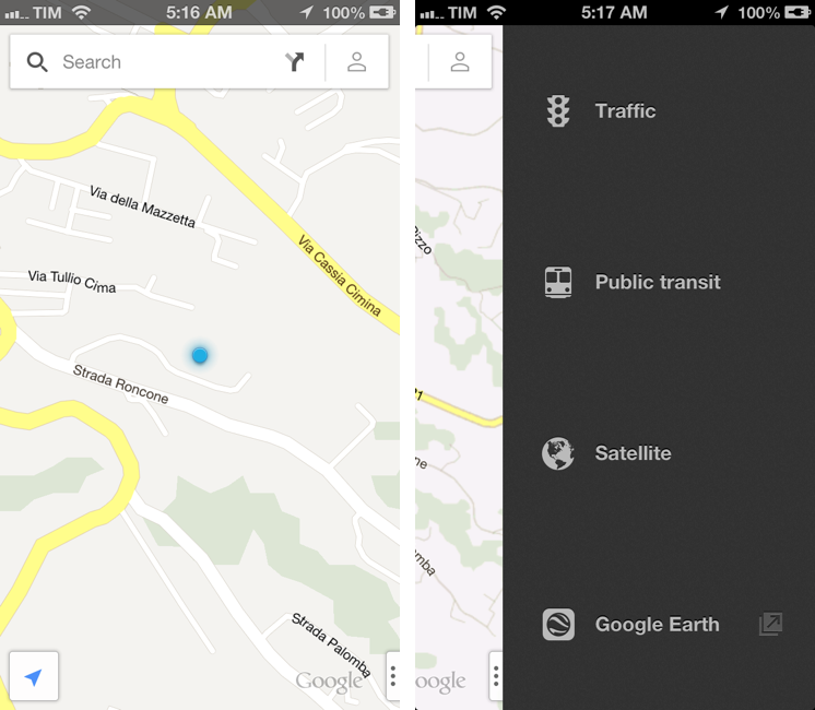
Since the release of iOS 6, I’ve been looking for apps and services to get Google Maps functionality back on my iPhone and iPad. While not as integrated as the previous Maps app of iOS 5, I’ve settled on a combination of various tools to access Google Maps for those times when Apple Maps fail me (unfortunately, most of the time in my area). Read more


Add a Speedometer to Maps in iOS

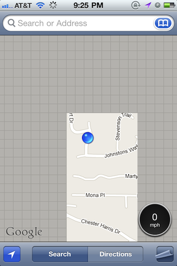
Traveling at the speed of light? Measure just how fast you’re going with a speedometer you can add to the Maps app via a Cydia tweak for Jailbroken iPhones. Speed for Maps is a small utility that you download to measure how fast you’re traveling in miles per hour, feet per second, kilometers per hour, meters per second, or knots if you’re traveling the high seas. A small, circular badge is added to Maps that displays your current speed — useful for biking and boating, but maybe not so much for driving where your panel instruments already give you everything you need. Regardless, it’s a simple tweak you can find in the Cydia repository if you’re interested in adding the tiny overlay.

[via FunkySpaceMonkey]


Legal Disclaimer In iOS 5 Further Hints At Apple Mapping Service

Tipped off by a reader, MacRumors has found that the legal disclaimers in iOS 5 contain new references to a number of third party companies that provide various mapping services. The disclaimers come under a new section called “Map Data” that is not present in previous disclaimers and is completely separate to the section which deals in the disclaimer which deals with licenses used by Google for its mapping service that is used by Apple in the Maps app.

Today’s discovery comes after a number of other revelations, together they form what seems to be the suggestion that Apple is looking (or potentially actively working on) its own mapping solution that could replace Google Maps on iOS. Some of those clues include its acquisition of mapping companies Placebase and Poly9 and its recruitment of employees with navigation software expertise. The location log debacle also revealed that Apple was “collecting anonymous traffic data to build a crowd-sourced traffic database”.

MacRumors had a look into all the companies newly listed in the legal disclaimer and gave a quick description of each of them (included below). Noting two companies in particular that suggest Apple may be developing its own maps service. Urban Mapping provides some extensive additional data such as a wide range of demographic information that can be layed on top of traditional data. Waze, however, is experienced in developing crowd-sourced traffic data - it also has a popular app in the App Store now which demonstrates a lot of their services.

  • CoreLogic offers Parcel data which marks boundaries for of properties to provide positional accuracy in location-based solutions.
  • Getchee provides location and market data on China, India and Southeast Asia.
  • Increment P Corp provides location and traffic data for Japan.
  • Localeze provides local business listings.
  • MapData Sciences Pty Ltd. Inc provides mapping data for Australia and New Zealand.
  • DMTI provides postal code data for Canada.
  • TomTom offers global TeleAtlas mapping data which is also licensed by Google for their map solution.
  • Urban Mapping provides in-depth neighborhood data such as crime, demographics, school performance, economic indicators and more.
  • Waze offers real-time maps and traffic information based on crowd sourced data.

Whilst this doesn’t provide concrete proof of whether Apple is working on its own mapping service, we are fairly sure it (if it exists) will not be launching with iOS 5. This is likely related to the fact that Google recently renewed its agreement with Apple to provide Google Maps to iOS.

Jump the break to see some screenshots of the new legal disclaimer which features these new companies.

[Via MacRumors]

Read more


Apple’s Data Center Makes A Google Maps Appearance

As noted by Philip Elmer-DeWitt at Fortune, Apple’s new data center in Maiden, North Carolina, is now visible in its entirety from Google Maps’s aerial view. The tidbit of information isn’t particularly interesting as far as the building goes – it’s the same white, anonymous construction we’ve been seeing in other shots from the past months – but the timing is interesting: according to Fortune, Apple started allowing Google to display the data center in their Maps service soon after the official WWDC announcement yesterday. In that announcement, Apple confirmed the WWDC keynote would see Steve Jobs and other executives on stage to unveil iOS 5, OS X Lion and iCloud. The data center was rumored to host a bevy of Internet services and online iTunes content, but the press release and the timing of this sudden Maps appearance seems to confirm that, yes, Maiden’s massive facility will be used for iCloud and all the cloud-related features of iOS 5 and OS X Lion.

But if you asked Google Earth or Google Maps to show you the intersection of U.S. Route 321 and Startown Road – where the data center is located – the current satellite imagery stopped a few yards short of the construction site. West of Startown Road, there was, as recently as two weeks ago, nothing but woods and farmland and a bit of driveway that ended abruptly in the middle of a field.

After Apple’s announcement Tuesday that Steve Jobs was ready to reveal iCloud – the “upcoming cloud services offering” presumably based in Maiden, N.C. – we thought we’d give Google Maps another try.

Lo and behold, there it was: A huge, white, nondescript building with a road leading in, a road leading out, and almost no employee parking.

The data center in Maiden, North Carolina, is rumored to go under an expansion at 1 million square feet (from the current 500,000) and other reports claimed Apple was using highly custom equipment and a unique design to power its new Internet services and applications. As speculation is running wild on how Apple will use the data center with iCloud and iTunes, the company has reportedly already commissioned a new, smaller data center in Santa Clara, California.


iOS 5 Won’t Feature Apple’s Maps Service, Google Maps Still In?

Following today’s reports on iOS 5 coming with completely revamped notifications and widgets, 9to5google claims the next major version of iOS 5 won’t feature the maps service Apple was rumored to be working on, but it will keep using Google Maps as in the current versions of iOS.

Now, sources have told 9to5Google that although Apple is working to improve the iOS Maps application, iOS 5 will not bring an Apple developed maps service and Google Maps is still in. Besides Apple’s purchase of both Placebase and Poly9, some speculated that Apple is building their own maps service to either compete with Google or step away from their input into iOS.

The speculation on a map service developed by Apple to replace Google Maps integration on iOS devices indeed started after the company purchased Poly9 and Placebase – two companies focused on mapping softwares and location databases – also followed by various job postings Apple put up on its site, asking for map engineers and navigation experts to bring Maps for iOS “to the next level.” Putting this information together, many believed Apple skipped iOS 4 only to bring its new and improved maps to iOS 5, set to become publicly available later this year, perhaps in the Fall. Apple also briefly mentioned in the location tracking Q&A that they’re building an “improved traffic service” to launch in the next couple of years, giving more credence to the reports of Apple developing its own system, rather than an additional layer to Google Maps.

Others also suggested the disputes between Steve Jobs and former Google CEO Eric Schmidt, as well as the competition with Android might be the reason behind Apple’s intention to drop Google Maps from iOS. While it might be true that Apple would rather use its own map solution rather than someone else’s, it’s worth noting that Google Maps is the de-facto solution for online maps (used by millions of users every day) and other Google services are embedded in iOS, such as Gmail integration and search.