This Week's Sponsor:

Kolide

Ensures that if a device isn’t secure it can’t access your apps.  It’s Device Trust for Okta.


Posts tagged with "maps"

Crowsflight Points You in the Right Direction

I think maps are useful when choosing your destination, but when navigating the city streets, orienting yourself by finding landmarks on a tiny screen can be tricky. I like this idea of having a pointer, a directional compass that at least tells you you’re heading in the right direction.

I like the concept behind this app. I could have used something like this a couple months ago when I ended up parking several blocks away from my destination (yay city parking). Maps got me close to my destination, but the walking directions didn’t quite follow the walking paths available and it’s semi easy to get lost in your phone instead of paying attention to your surroundings. Crowsflight shows you were you should be looking for your destination, features a quick search feature (useful when stuck on slow 3G), and built-in maps as an additional way to find nearby points of interest. It’s one of those things where you ask yourself why you need another compass, and end up realizing that it can be super useful when smart features are attached.

You can download Crowsflight for free from the App Store, and unlock all of the features for a dollar via an in-app purchase.

Permalink

Google Maps SDK For iOS And URL Scheme

Google Maps SDK For iOS And URL Scheme

Alongside the launch of its official Maps app for iPhone, Google has also released a developer SDK to let third-party apps embed Google Maps directly. As detailed by Andrew Foster at the Google Geo Developers blog, the SDK – which requires signing up for API access – will allow developers to integrate Google Maps with their own apps, displaying embedded 2D or 3D Maps views with markers and info windows. The blog post also confirms that the SDK will work on the iPad; Google has confirmed to The New York Times that a native iPad version of Maps is indeed coming.

The SDK features vector-based maps that load quickly, allowing users to easily navigate 2D and 3D views, rotating and tilting the map with simple gestures inside your app. Developers can also change the Google maps view to include information such as traffic conditions, and control camera positions in 3D.

In the SDK documentation, Google says that the appearance of Maps embedded through the SDK is the same of the Google Maps apps, and that the SDK “exposes many of the same features”.

However, the SDK isn’t the only way for developers to integrate with Google Maps. Using a URL scheme, developers can point to the Google Maps app and launch it from their app into a specific view or map object. Documentation for the URL scheme is available here. Developers can link to Google Maps with specific views, modes (standard or Street View), set zoom levels, and pass directions with the URL scheme.

It’ll be interesting to see how and when Google Maps-compatible apps such as AroundMe or WhereTo will support the new Google Maps SDK. The addition of a URL scheme shouldn’t be underestimated either, as it’ll enable regular users to launch the app using tools like Launch Center Pro.

Permalink

Google Releases Maps App For iPhone

In spite of “sources at Google” claiming that Apple wouldn’t accept a Google Maps app in the App Store, Google has today released its official Maps application for iPhone. The app just went live on the App Store, and it’s available as a free download here.

Following Apple’s debacle with their Maps software for iOS 6, Google was rumored to be preparing a third-party version of Google Maps for iOS devices. We haven’t been able to test this yet, and we’ll post our impressions of the software on MacStories once we’re able to properly use the app. Read more


Getting Google Maps Back On iOS 6

Since the release of iOS 6, I’ve been looking for apps and services to get Google Maps functionality back on my iPhone and iPad. While not as integrated as the previous Maps app of iOS 5, I’ve settled on a combination of various tools to access Google Maps for those times when Apple Maps fail me (unfortunately, most of the time in my area). Read more


Tim Cook Writes Open Letter To Customers, Apologizes For Maps ‘Frustration’

Apple has just posted on its website a letter from Tim Cook to Apple’s customers, apologizing for not delivering the best experience with its new iOS 6 Maps. In the letter, prominently link to from the front page of Apple.com,  Cook describes how Apple “strives” to make products the “deliver the best experience possible”, but that the new Maps app has fallen short of this standard, frustrating millions of customers.

He re-emphasises the previous Apple statement on Maps, by saying that as time goes on and more people use Maps (there have already been nearly half a billion location searches), that the Maps app will get better. But in the mean time, Cook suggests that users try alternative map apps, and actually names some third-party apps available in the App Store such as “Bing, MapQuest and Waze” or alternatively to use “use Google or Nokia maps by going to their websites and creating an icon on your home screen to their web app”. Whilst that is certainly far from ideal, it’s quite extraordinary to see Cook actively name and recommend third party mapping solutions.

Cook explains that since they first shipped the original iPhone, they’ve been wanting to add new features such as “turn-by-turn directions, voice integration, Flyover and vector-based maps”. Cook claims that they had to create a new version “from the ground-up” to achieve these - there is no mention of Google’s role in the letter.

Tim Cook’s full letter to customers:

To our customers,

At Apple, we strive to make world-class products that deliver the best experience possible to our customers. With the launch of our new Maps last week, we fell short on this commitment. We are extremely sorry for the frustration this has caused our customers and we are doing everything we can to make Maps better.

We launched Maps initially with the first version of iOS. As time progressed, we wanted to provide our customers with even better Maps including features such as turn-by-turn directions, voice integration, Flyover and vector-based maps. In order to do this, we had to create a new version of Maps from the ground up.

There are already more than 100 million iOS devices using the new Apple Maps, with more and more joining us every day. In just over a week, iOS users with the new Maps have already searched for nearly half a billion locations. The more our customers use our Maps the better it will get and we greatly appreciate all of the feedback we have received from you.

While we’re improving Maps, you can try alternatives by downloading map apps from the App Store like Bing, MapQuest and Waze, or use Google or Nokia maps by going to their websites and creating an icon on your home screen to their web app.

Everything we do at Apple is aimed at making our products the best in the world. We know that you expect that from us, and we will keep working non-stop until Maps lives up to the same incredibly high standard.

Tim Cook
Apple’s CEO


A Reasonable Take On Apple’s Maps Problem

A Reasonable Take On Apple’s Maps Problem

Mike Dobson of TeleMapics has published a balanced, reasonable, and informative article on the various technical issues that Apple is facing with the new Maps on iOS 6.

The issue plaguing Apple Maps is not mathematics or algorithms, it is data quality and there can be little doubt about the types of errors that are plaguing the system. What is happening to Apple is that their users are measuring data quality. Users look for familiar places they know on maps and use these as methods of orienting themselves, as well as for testing the goodness of maps. They compare maps with reality to determine their location. They query local businesses to provide local services. When these actions fail, the map has failed and this is the source of Apple’s most significant problems. Apple’s maps are incomplete, illogical, positionally erroneous, out of date, and suffer from thematic inaccuracies.

Alongside his sarcasm-free explanation of many aspects of building a mapping solution, Mike offers some suggestions that are worth considering as well.

It’s a recommended read, which I suggest checking out here.

Permalink

Apple: “The More People Use Maps, The Better It Will Get”

Apple: “The More People Use Maps, The Better It Will Get”

In a statement sent to AllThingsD, Apple said they are working hard to improve the customer experience with the new Maps of iOS 6. In particular, the company notes that “it’ll get better” with time and usage.

We launched this new map service knowing it is a major initiative and that we are just getting started with it. Maps is a cloud-based solution and the more people use it, the better it will get. We appreciate all of the customer feedback and are working hard to make the customer experience even better.

In my review of iOS 6 yesterday, I dedicated a section to Maps, comparing its features to those of iOS 5’s Google Maps product in Italy. Following yesterday’s launch, people have increasingly noticed that Maps, unlike Google Maps, is lacking in several areas like business listings, satellite views, Flyover accuracy, and more. Screenshots of Maps discrepancies with reality and plain-wrong data are all over the web.

In our Reading List in the sidebar (on the right), we’ve collected some of the best Maps-related articles from around the web.

There’s no denying that Maps will get better with time and usage. But unlike Siri, which Apple also said will get better with time, people have become dependent upon accurate maps for their livelihood. If I really had to nitpick, though, I, too, am curious to know how actually Apple plans to improve Maps without allowing customers to actively suggest other options.

Personally, I wonder how users who had (and will have) real-life issues like this would react to Apple’s statement.

Permalink

On The Benefit Of iOS 6 Maps

On The Benefit Of iOS 6 Maps

Anil Dash, writing about his experiences with Apple’s Maps on iOS 6:

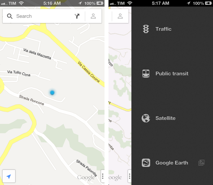
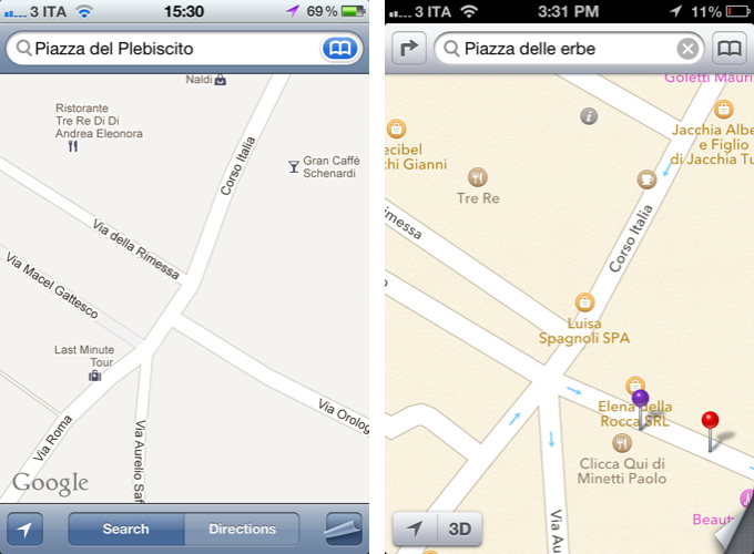
Here in Manhattan, where I live, basic search by building names is profoundly degraded in Apple’s maps search. “Bloomberg” doesn’t find the Bloomberg Tower; on Google Maps it’s the first result. Searching for its address “731 Lexington Avenue” yields that address on Lexington Avenue in Brooklyn. It’s fine to think that perhaps I wanted the address in Bed-Stuy, but even appending “NY, NY” or “Manhattan, NY” still yields the Brooklyn address. Google maps has none of these comprehension issues. I understand this is due to Apple partnering with Tom Tom, whose maps are considered to be lower in quality than other players like Nokia, but I’m not informed enough to say with certainty whether that’s the case.

In response to our iOS 6 coverage (my thoughts on iOS 6 here, Cody’s overview of Maps here) TomTom sent us the following statement:

TomTom supplies maps and related content to the majority of handheld players, including RIM, HTC, Samsung, AOL (MapQuest Mobile), Apple and, yes, Google (for the areas where they don’t make their own maps).

Our maps are used by businesses around the world, which have standards for coverage, detail, quality and safety.

When people use a map, their experience is determined by two things. Firstly, the underlying content, notably the maps. This is what TomTom is currently supplying the mobile industry with and it is what gives their maps the best foundation. Secondly, user experience is determined by adding additional features to the map application, such as visual imagery. This is typically defined and created by the handset manufacturers and third party software providers on the basis of their own vision and needs.

If I understand this correctly, TomTom is essentially implying that, because user experience is defined by “additional features” (such as Apple’s custom map tiles, I assume), then issues with the user experience are also related to the choices made by “the handset manufacturer”.

I do believe, however, that the problems mentioned by Dash (poor recognition of POIs, questionable detection of local addresses) – the same ones I mentioned in my piece – aren’t related to Apple’s “vision” and “visual imagery”. Here’s Business Insider yesterday, reporting about an interview with Waze CEO Noam Bardin (Waze is also listed in Maps’ copyright notices):

But Bardin says that Apple has taken a huge bet by partnering with TomTom, a maker of traditional GPS hardware that’s morphing into a mapping-data provider. Both TomTom and Waze are listed in Apple’s copyright notice as providers of map data. But Bardin’s observations suggest that Apple is relying predominantly on TomTom.

“Apple went out and partnered with the weakest player,” Bardin says. “They’re now coming out with the lowest, weakest data set and they’re competing against Google, which has the highest data set.

Ultimately, it simply comes down to having a good experience – no matter who puts in the data. But it’ll be interesting to see how fast Apple will manage to iterate on its new Maps.

Update: After asking whether issues with the visualization of maps were related to Apple’s imagery, TomTom provided us with an additional statement:

Yes, we did not develop the map application. Rather, we only provide the data to build a car-centric map foundation. Everything thing on top of that - routing, visualization, etc. - is determined by the supplier.

Permalink

Hands On with iOS 6 Maps

When Apple launched the iPhone in 2007, Google was a partner and not a competitor. Apple’s Maps, with data supplied by Google, was famously demoed by Steve Jobs when he searched for nearby Starbucks establishments and made a prank phone call with a tap of his finger. When Apple unveiled their iPad three years later in 2010, Steve Jobs was equally delighted to show off Maps, as he pinched the display to get a bigger overhead view of the Eiffel tower.

Initially, Maps was a simple mobile companion to Google Maps. Standard, hybrid, and satellite views were there, as was the ability to show traffic congestion and get driving directions between two locations of interest. It wasn’t until just over a year later with iOS 2.2 that Maps was improved with walking directions, public transit information, and street view. On the iPad, a terrain view was added. Alternate routes for directions came later in iOS 5 alongside estimated time of arrival and the ability to print directions via AirPrint. Over time, it became a robust Maps application that was better than Google Maps on the web.

What Apple did with Google Maps was pretty incredible when it was first introduced with the iPhone and later on the iPad. In contrast to using sliders and buttons on the web, Apple demonstrated that maps could be intuitive to navigate with just your fingertips. Panning around a map with your finger, tapping on search results to pull up business information, and navigating the world with Street View simply felt right on a touchscreen. Google provided often accurate search results and map data, while Apple provided a delightful interface to show their world through.

Today, using maps on our smartphones to find our way is an everyday habit. Frequent fliers rely on their smartphones to find their way in new locales, while city dwellers actively use smartphones to request public transit information. The convenience offered by our smartphones makes it possible for us to actively plan our days around city schedules, plan road trips, and get directions to a business for an all important interview. Beyond Apple’s Maps, companies like TomTom, Garmin, and Navigon added to the iPhone’s capabilities by providing real-time navigation and voice-guided directions through apps from the App Store. Yet competitors, such as Android with Google Maps and Google Maps Navigation, and Windows Phone 7 with Bing Maps and Nokia Drive, were offering GPS navigation on their ecosystems for free. For iOS 6, the missing piece to be filled-in for Apple’s Maps would have to be such a feature.

In iOS 6, Apple’s Maps is a headlining feature. During this year’s WWDC 2012 Keynote on June 11th, turn-by-turn navigation was showcased for Apple’s brand new Maps application in concert with the display of real-time traffic conditions. Apple added interactive 3D views and Flyover to select cities, giving maps a 3rd dimension on top of a traditional satellite view. As impressive as Apple’s demonstrations were, the most interesting feature are Apple’s new vector based maps, completely redesigned “from the ground up” as a replacement for Google’s Map data.

Read more