One of my favorite games on SNES was Lemmings. Sticklings, by Austrian development house Djinnworks, is a clear evolution of the core elements of Lemmings, but with creative twists that make Sticklings an addictive casual puzzle game in its own right.
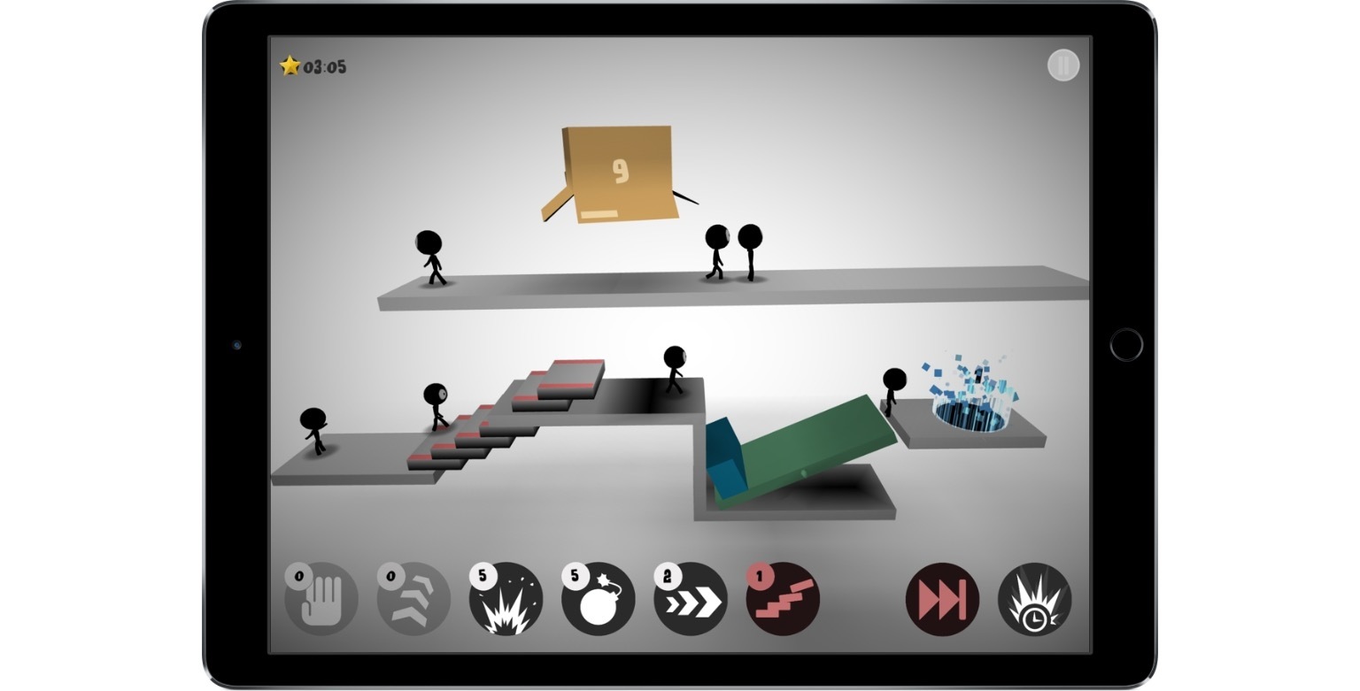
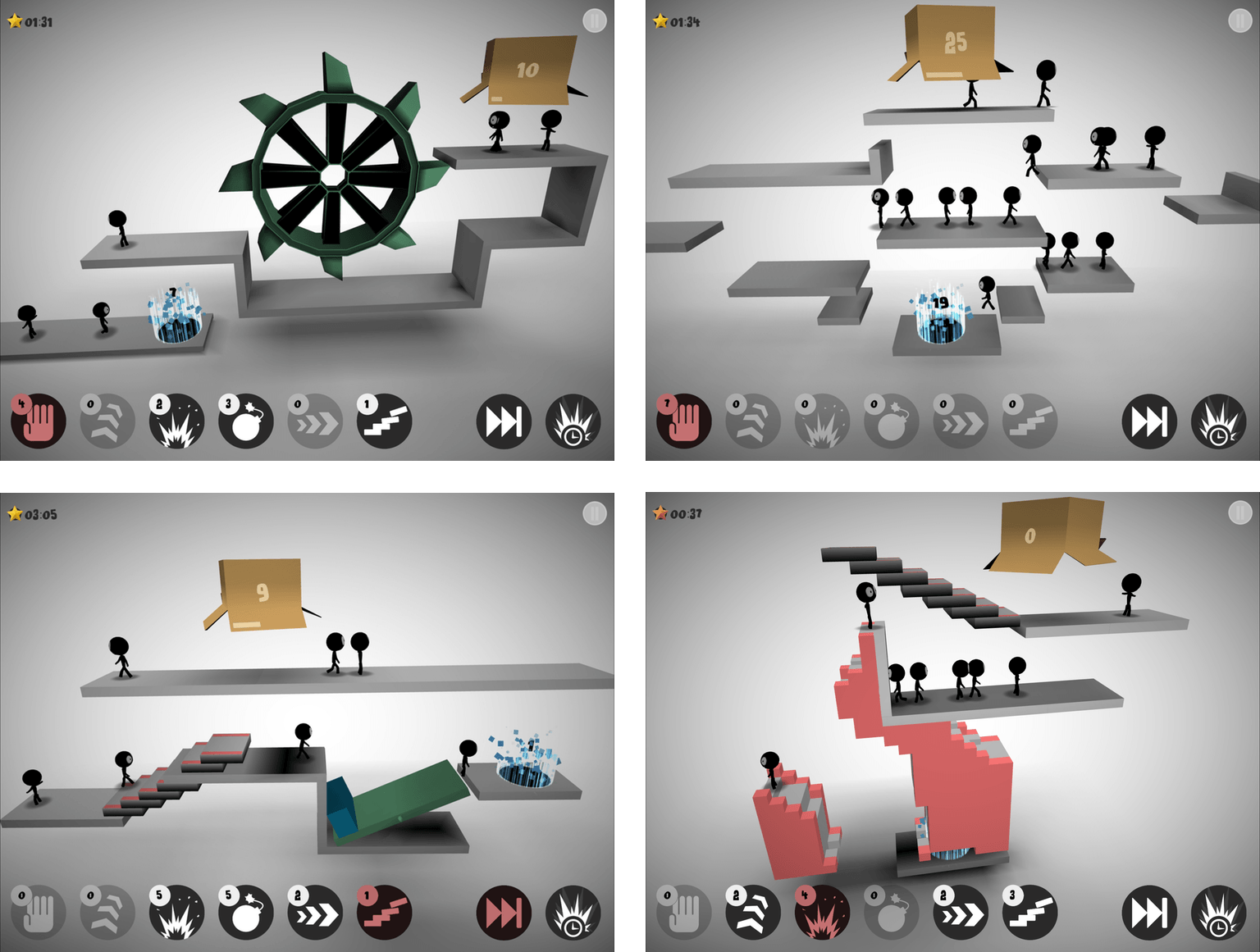
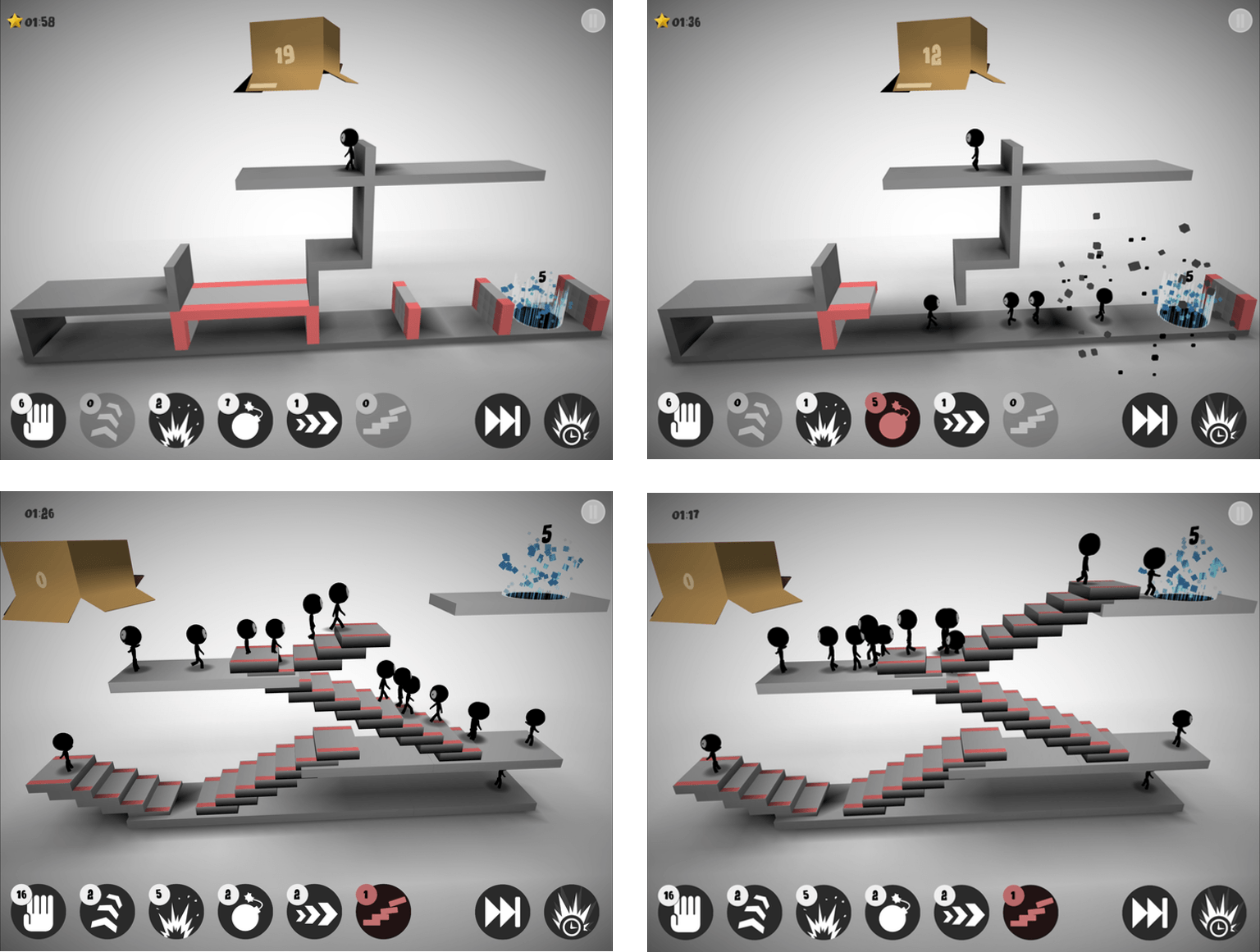
Stick figures emerge from a box at regular intervals. Your job is to maneuver them to a glowing portal. Each progressively harder level requires you to steer a certain number of stick figures into the portal before time runs out.
If you do nothing, stick figures will walk off the end of platforms, disappearing as they seemly melt into the background. To get the stick figures to their destination, each level has some combination of up to six tools that give your stick figures special abilities. You need to use abilities sparingly though, because Sticklings limits the number of each tool you get per level. Among other things, you can use stick figures as ‘blockers’ that reverse the course of figures that walk into them, for building staircases to clear obstacles, or for throwing bombs that blow up barriers.
Sticklings is striking. The first thing you’ll notice is the spare use of color. Each 3D puzzle is rendered almost entirely in grayscale and lit from above in a way that adds to the game’s dimensionality. Special segments of the platforms are in color as is the the box from which your stick figures emerge and the portal goal to which you steer them, but that’s about it. The effect gives the game a modern, abstract feeling that I like.
There are a couple things that bother me about Sticklings. The first is interstitial ads for Djinnworks’ other apps when you start the game and between levels. I don’t mind a link to other apps by a developer that I can choose to tap, but these appear full screen and require you to tap a tiny ‘x’ that doesn’t appear for a couple seconds, which is is too disruptive for my taste. I also don’t like that progress isn’t synced between devices, which is an all too common occurrence among iOS games.
That said, I like Sticklings for the Lemmings nostalgia factor, the visual aesthetic, and the challenging puzzles. A few of the games I’ve reviewed lately have been ones where you’ll want to set aside some time to play. Sticklings is perfect for killing time and boredom by playing a few levels here and there as time permits.
Sticklings is available on the App Store for $0.99.